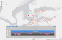
Item (Elevation Profile)
Item Card (XML) | Package Info| ID | 001fc8b758b84dafb692e1d44d6b4aef |
| Item | 001fc8b758b84dafb692e1d44d6b4aef |
| Item Type | text |
| Owner | esri_en |
| Uploaded | Oct 12, 2015 |
| Modified | Oct 12, 2015 |
| Thumbnail |

|
| GUID | N/A |
| Name | N/A |
| Title | Elevation Profile |
| Type | Web Mapping Application |
| Type Keywords | Configurable, createAppWithoutMap, JavaScript, Map, Mapping Site, Online Map, sourceId#016c4ea23130446fb9f7e0fbdd5c58bd, summarize, Web Map |
| Description | Elevation Profile is a configurable app template used to display the elevation profile for a selected feature or a measured line along with a web map. This template uses the Profile geoprocessing service to generate the elevation values along the profile. View the Profile service developer documentation for additional details. Use Cases Generates an elevation profile graph based on a selected line feature in the map or a line drawn with the measure tool.
Configurable Options Use Elevation Profile to present content from a web map and configure it using the following options:
Supported Devices This application is responsively designed to support use in browsers on desktops, mobile phones, and tablets. Data Requirements This application has no data requirements. Get Started This application can be created in the following ways:
|
| Tags | ArcGIS web application template |
| Snippet | Generates an elevation profile for line features in the map or for lines drawn using the measure tool. |
| Extent | N/A |
| Spatial Reference | N/A |
| Access Information | N/A |
| License Information | This application will work with ArcGIS public accounts in addition to subscription based accounts. |
| Culture | en-us |
| Properties | N/A |
| Url | /apps/Profile/index.html |
| Proxy Filter | N/A |
| Last Modified | N/A |
| Size | 7448 |
| Documentation | N/A |
| App Categories | N/A |
| Industries | N/A |
| Languages | N/A |
| Screenshots |
screenshots/Profile4.png screenshots/Profile3.png screenshots/Profile2.png screenshots/Profile1.png |
| Listed | false |
| Comments Enabled | true |
| # Comments | 0 |
| # Ratings | 0 |
| Avg. Rating | 0.0 |
| # Views | 193 |
| Categories | |
| Content Status |
Child Resources: Comments Rating Groups Item Data Item Data as Zip Item Dependencies
Supported Operations: Add Comment Add Rating Delete Rating Related Items Share Item Unshare Item Package Item Set Item Content Status