Item (Shaded Relief)
Item Card (XML) | Package Info| ID | 067b9f0d0f204696a26f1a1f21551c6e |
| Item | Shaded_Relief.rft.json |
| Item Type | file |
| Owner | esri_en |
| Uploaded | Nov 15, 2018 |
| Modified | Nov 15, 2018 |
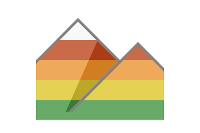
| Thumbnail |
|
| GUID | N/A |
| Name | N/A |
| Title | Shaded Relief |
| Type | Raster function template |
| Type Keywords | ArcGIS Raster Function Templates, categoryName#SurfaceSystem_RFT, Function Template, Functions, Processing, Raster, rft, sourceId#Shaded ReliefSystem_RFT, Templates |
| Description | The Shaded relief function creates a color 3D representation of the terrain is created by merging the images from the elevation-coded and hillshade methods. This function uses the altitude and azimuth properties to specify the sun's position.
|
| Tags | System Raster Function, Raster Function Template, Surface, Shaded Relief |
| Snippet | Creates a multiband, color coded, 3D representation of the surface, with the sun's relative position taken into account for shading the image. |
| Extent | N/A |
| Spatial Reference | N/A |
| Access Information | Esri, Inc. |
| License Information | This raster function template may be used to process your imagery using ArcGIS Image Server. |
| Culture | english (united states) |
| Properties | N/A |
| Url | N/A |
| Proxy Filter | N/A |
| Last Modified | N/A |
| Size | 2807 |
| Documentation | N/A |
| App Categories | N/A |
| Industries | N/A |
| Languages | N/A |
| Listed | false |
| Comments Enabled | true |
| # Comments | 0 |
| # Ratings | 0 |
| Avg. Rating | 0.0 |
| # Views | 354 |
| Categories | |
| Content Status |
Child Resources: Comments Rating Groups Item Data Item Data as Zip Item Dependencies
Supported Operations: Add Comment Add Rating Delete Rating Related Items Share Item Unshare Item Package Item Set Item Content Status