Item (Story Map Cascade)
Item Card (XML) | Package Info| ID | 0db1bf8d3d604a1cbf1b6abf04fd6999 |
| Item | 0db1bf8d3d604a1cbf1b6abf04fd6999 |
| Item Type | text |
| Owner | esri_en |
| Uploaded | Jun 1, 2016 |
| Modified | Jun 1, 2016 |
| Thumbnail |

|
| GUID | N/A |
| Name | N/A |
| Title | Story Map Cascade |
| Type | Web Mapping Application |
| Type Keywords | Configurable, createAppWithoutMap, JavaScript, Map, Mapping Site, Online Map, selfConfigured, sourceId#9d84ba24d0ba428ebf34cb389e46fd1a, story, Web Map |
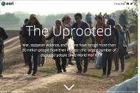
| Description | Story Map Cascade is a Story Map application that presents a narrative as a full-screen, scrolling experience. This application is ideal for creating compelling immersive stories that include images, video, and 2D and 3D maps, especially when you have a lot of text and detail to convey. When you configure a Cascade story, an interactive builder makes it easy to create your story. Use Cases Story Map Cascade can be used to tell map-based stories on any topic. Here are some examples:
For more examples of stories created with Story Map Cascade visit the gallery on the Esri Story Maps website. Configurable Options Story Map Cascade is a storytelling app that can be configured to include maps and scenes as well as other media such as images, videos, web apps, and web pages. Scenes can be configured to show a location, perspective, and set of layers by selecting an existing scene slide. Supported Devices This application is responsively designed to support use in browsers on desktops, mobile phones, and tablets. Data Requirements Story Map Cascade does not require any geographic content but can include ArcGIS web maps and scenes. It also supports images (either uploaded in builder or referenced from the web), videos (from the web), and web pages. Get Started This application can be created in the following ways:
For more information, including a step-by-step tutorial, visit the Story Map Cascade page on the Esri Story Maps website. |
| Tags | story map, Story Map Cascade, cascade, Esri Story Maps, ArcGIS web application template, storytelling, scroll, scrolling |
| Snippet | Present a narrative with 2D and 3D maps and other media as a full-screen, scrolling, immersive experience. |
| Extent | N/A |
| Spatial Reference | N/A |
| Access Information | N/A |
| License Information | N/A |
| Culture | en-us |
| Properties | N/A |
| Url | /apps/Cascade/index.html |
| Proxy Filter | N/A |
| Last Modified | N/A |
| Size | 0 |
| Documentation | N/A |
| App Categories | N/A |
| Industries | N/A |
| Languages | N/A |
| Screenshots |
screenshots/cascade_1.png screenshots/cascade_2.png screenshots/cascade_3.png |
| Listed | false |
| Comments Enabled | true |
| # Comments | 0 |
| # Ratings | 0 |
| Avg. Rating | 0.0 |
| # Views | 213 |
| Categories | |
| Content Status |
Child Resources: Comments Rating Groups Item Data Item Data as Zip Item Dependencies
Supported Operations: Add Comment Add Rating Delete Rating Related Items Share Item Unshare Item Package Item Set Item Content Status