Item (Watering Violations)
Item Card (XML) | Package Info| ID | 2a806cd41ac648ccbd2ea70e5c8e3a6e |
| Item | 2a806cd41ac648ccbd2ea70e5c8e3a6e |
| Item Type | text |
| Owner | esri |
| Uploaded | Sep 26, 2016 |
| Modified | Sep 26, 2016 |
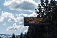
| Thumbnail |
|
| GUID | N/A |
| Name | N/A |
| Title | Watering Violations |
| Type | Layer Template |
| Type Keywords | Collector, Data, Feature Service Template, Layer, Layer Template, Platform, Platform Template, Service Template, sourceId#58b9b4a15a774f62b8100f1645ceda93, Template, Water Utilities, Watering Violations |
| Description | Record locations and details about watering violations. |
| Tags | Water Restriction, Watering Violations, Water Conservation |
| Snippet | Enables field crews to log watering violations. |
| Extent | [-180.0, -90.0] - [180.0, 90.0] |
| Spatial Reference | NAD_1983_HARN_StatePlane_Illinois_East_FIPS_1201 |
| Access Information | Esri., Inc. |
| License Information | N/A |
| Culture | en-us |
| Properties | N/A |
| Url | N/A |
| Proxy Filter | N/A |
| Last Modified | N/A |
| Size | 23044 |
| Documentation | N/A |
| App Categories | N/A |
| Industries | N/A |
| Languages | N/A |
| Listed | false |
| Comments Enabled | true |
| # Comments | 0 |
| # Ratings | 0 |
| Avg. Rating | 0.0 |
| # Views | 256 |
| Categories | |
| Content Status |
Child Resources: Comments Rating Groups Item Data Item Data as Zip Item Dependencies
Supported Operations: Add Comment Add Rating Delete Rating Related Items Share Item Unshare Item Package Item Set Item Content Status