Item (รูปแบบชั้นข้อมูลประเภทรูปทรงของ Esri)
Item Card (XML) | Package Info| ID | 3c841af4f40d4f048b47da6f2ba5e3bc |
| Item | 2a2666a7994542a78f4888e6e0a50653 |
| Item Type | text |
| Owner | esri_th |
| Uploaded | Sep 11, 2014 |
| Modified | Sep 11, 2014 |
| Thumbnail |
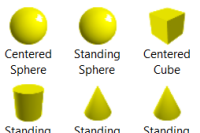
|
| GUID | N/A |
| Name | EsriThematicShapesLayerTemplate |
| Title | รูปแบบชั้นข้อมูลประเภทรูปทรงของ Esri |
| Type | Layer Template |
| Type Keywords | EsriThematicShapesLayerTemplate, Layer, Platform, sourceId#2a2666a7994542a78f4888e6e0a50653, Template |
| Description | ชั้นข้อมูลจุดที่กำหนดสำหรับเว็บซีนเหมาะสำหรับหัวเรื่องที่เป็นตัวแทนของข้อมูลโดยใช้รูปทรง 3 มิติ สัญลักษณ์เหล่านี้จะแสดงในพื้นที่ทางกายภาพทำให้พวกเขามีประโยชน์สำหรับการสื่อสารข้อมูลทั้งในโลกจริงและข้อมูลเปรียบเทียบใจ แม่แบบรวมถึงรูปทรงเรขาคณิตต่างๆที่ได้รับการกำหนดที่มีจุดยึดและค่านิยมในการหมุน เลือกสัญลักษณ์ที่จะมีสีและปรับขนาดโดยใช้แอตทริบิวต์ของคุณลักษณะที่ช่วยให้พวกเขาที่ดีกว่าการอธิบายลักษณะคุณสมบัติของแต่ละคน |
| Tags | แพลตฟอร์ม, รูปแบบ, ชั้นข้อมูล, สไตลย์, รูปแบบชั้นข้อมูล, 3 มิติ, ประเภทแผนที่, รูปร่าง, รูปร่างประเภทแผนที่, รูปทรงกลม, รูปทรงกรวย, รูปทรงกระบอก, รูปทรงเพชร, รูปทรงจตุรมุข, รูปทรงสี่เหลี่ยม |
| Snippet | รูปแบบชั้นข้อมูลที่กำหนดล่วงหน้าสำหรับให้สัญลักษณ์แบบจุดเป็นประเภทต้นไม้ที่จำแนกแล้ว |
| Extent | N/A |
| Spatial Reference | N/A |
| Access Information | N/A |
| License Information | N/A |
| Culture | en-us |
| Properties | N/A |
| Url | N/A |
| Proxy Filter | N/A |
| Last Modified | N/A |
| Size | 703 |
| Documentation | N/A |
| App Categories | [] |
| Industries | [] |
| Languages | [] |
| Listed | false |
| Comments Enabled | true |
| # Comments | 0 |
| # Ratings | 0 |
| Avg. Rating | 0.0 |
| # Views | 221 |
| Categories | |
| Content Status |
Child Resources: Comments Rating Groups Item Data Item Data as Zip Item Dependencies
Supported Operations: Add Comment Add Rating Delete Rating Related Items Share Item Unshare Item Package Item Set Item Content Status