Item (Segment Mean Shift)
Item Card (XML) | Package Info| ID | 3f4ab7ac8e5e439080f74613f4ad2129 |
| Item | Segment_Mean_Shift.rft.json |
| Item Type | file |
| Owner | esri_sr |
| Uploaded | Jan 7, 2019 |
| Modified | Jan 7, 2019 |
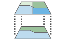
| Thumbnail |
|
| GUID | N/A |
| Name | N/A |
| Title | Segment Mean Shift |
| Type | Raster function template |
| Type Keywords | ArcGIS Raster Function Templates, categoryName#ClassificationSystem_RFT, Function Template, Functions, Processing, Raster, rft, sourceId#Segment Mean ShiftSystem_RFT, Templates |
| Description | Ova funkcija identifikuje objekte, geoobjekte ili segmente u vašim snimcima grupisanjem susednih piksela koji imaju slične spektralne i prostorne karakteristike. Možete da kontrolišete količinu prostornog i spektralnog poravnavanja kako biste pomogli u izvođenju geoobjekata od interesa. |
| Tags | Sistemska rasterska funkcija, Šablon rasterske funkcije, Klasifikacija, Segment Mean Shift |
| Snippet | Grupiše susedne piksele sa sličnim spektralnim karakteristikama u segmente. |
| Extent | N/A |
| Spatial Reference | N/A |
| Access Information | Esri, Inc. |
| License Information | Ovaj šablon rasterske funkcije može da se koristi za obradu vaših snimaka korišćenjem ArcGIS Image Server. |
| Culture | english (united states) |
| Properties | N/A |
| Url | N/A |
| Proxy Filter | N/A |
| Last Modified | N/A |
| Size | 1581 |
| Documentation | N/A |
| App Categories | N/A |
| Industries | N/A |
| Languages | N/A |
| Listed | false |
| Comments Enabled | true |
| # Comments | 0 |
| # Ratings | 0 |
| Avg. Rating | 0.0 |
| # Views | 133 |
| Categories | |
| Content Status |
Child Resources: Comments Rating Groups Item Data Item Data as Zip Item Dependencies
Supported Operations: Add Comment Add Rating Delete Rating Related Items Share Item Unshare Item Package Item Set Item Content Status