Item (Ground Control)
Item Card (XML) | Package Info| ID | 4b6c9faf9cf34e2daa77795ef8d01ad2 |
| Item | 4b6c9faf9cf34e2daa77795ef8d01ad2 |
| Item Type | text |
| Owner | esri_apps |
| Uploaded | Nov 9, 2015 |
| Modified | Nov 9, 2015 |
| Thumbnail |
|
| GUID | N/A |
| Name | N/A |
| Title | Ground Control |
| Type | Layer Template |
| Type Keywords | Collector, Data, Feature Service Template, General, Ground Control, Layer, Layer Template, Platform, Platform Template, Service Template, sourceId#de01544733b64838a3028eecdf00b203, Template |
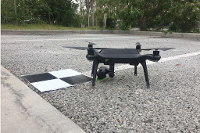
| Description | Map for ground Control point collection for use in georeferencing aerial drone imagery. |
| Tags | Ground Control, Collector, ArcGIS |
| Snippet | Map for ground control point collection for use in georeferencing aerial drone imagery. |
| Extent | [-180.0, -90.0] - [180.0, 90.0] |
| Spatial Reference | WGS_1984_Web_Mercator_Auxiliary_Sphere |
| Access Information | N/A |
| License Information | N/A |
| Culture | en-us |
| Properties | N/A |
| Url | N/A |
| Proxy Filter | N/A |
| Last Modified | N/A |
| Size | 4660 |
| Documentation | N/A |
| App Categories | N/A |
| Industries | N/A |
| Languages | N/A |
| Listed | false |
| Comments Enabled | false |
| # Comments | 0 |
| # Ratings | 0 |
| Avg. Rating | 0.0 |
| # Views | 240 |
| Categories | |
| Content Status |
Child Resources: Rating Groups Item Data Item Data as Zip Item Dependencies
Supported Operations: Add Rating Delete Rating Related Items Share Item Unshare Item Package Item Set Item Content Status