Item (곡률(Curvature))
Item Card (XML) | Package Info| ID | 6122b431d45a401b9e337c27975bd0a2 |
| Item | Curvature.rft.json |
| Item Type | file |
| Owner | esri_ko |
| Uploaded | Jan 7, 2019 |
| Modified | Jan 7, 2019 |
| Thumbnail |
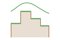
|
| GUID | N/A |
| Name | N/A |
| Title | 곡률(Curvature) |
| Type | Raster function template |
| Type Keywords | ArcGIS Raster Function Templates, categoryName#SurfaceSystem_RFT, Function Template, Functions, Processing, Raster, rft, sourceId#CurvatureSystem_RFT, Templates |
| Description | 곡률 함수는 경사의 모양이나 곡률을 표시합니다. 표면의 일부는 오목하거나 볼록할 수 있는데, 곡률 값을 검토하여 이를 구별할 수 있습니다. 곡률은 표면의 두 번째 파생물을 컴퓨팅하여 계산됩니다. 침식 및 유출 과정을 이해하기 위한 노력으로, 곡률 함수의 결과를 사용하여 배수 유역의 물리적 특성을 나타낼 수 있습니다. 곡률값을 사용하여 토양 침식 패턴과 토지 내 수역 분포를 확인할 수 있습니다. 측면 곡률은 흐름의 가속 및 감속에 영향을 주므로 침식 및 퇴적에 작용합니다. 평면도 곡률은 흐름의 수렴 및 발산에 영향을 줍니다. |
| Tags | 시스템 래스터 함수, 래스터 함수 탬플릿, 표면, 곡률(Curvature) |
| Snippet | 측면 윤곽 및 평면 곡률을 선택적으로 포함하여 래스터 표면의 곡률을 계산합니다. |
| Extent | N/A |
| Spatial Reference | N/A |
| Access Information | Esri, Inc. |
| License Information | 이 래스터 함수 템플릿은 ArcGIS Image Server를 사용하여 이미지를 처리하는 데 사용할 수 있습니다. |
| Culture | english (united states) |
| Properties | N/A |
| Url | N/A |
| Proxy Filter | N/A |
| Last Modified | N/A |
| Size | 1098 |
| Documentation | N/A |
| App Categories | N/A |
| Industries | N/A |
| Languages | N/A |
| Listed | false |
| Comments Enabled | true |
| # Comments | 0 |
| # Ratings | 0 |
| Avg. Rating | 0.0 |
| # Views | 185 |
| Categories | |
| Content Status |
Child Resources: Comments Rating Groups Item Data Item Data as Zip Item Dependencies
Supported Operations: Add Comment Add Rating Delete Rating Related Items Share Item Unshare Item Package Item Set Item Content Status