Item (Swath)
Item Card (XML) | Package Info| ID | 7f2dc43787ab456a8fccb4ea561cbd4b |
| Item | Swath.rft.json |
| Item Type | file |
| Owner | esri_en |
| Uploaded | Nov 15, 2018 |
| Modified | Nov 15, 2018 |
| Thumbnail |
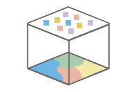
|
| GUID | N/A |
| Name | N/A |
| Title | Swath |
| Type | Raster function template |
| Type Keywords | ArcGIS Raster Function Templates, categoryName#Data ManagementSystem_RFT, Function Template, Functions, Processing, Raster, rft, sourceId#SwathSystem_RFT, Templates |
| Description | Some netCDF or HDF datasets store their geolocation as irregularly spaced arrays. When adding these datasets to a mosaic dataset, the swath function takes the irregularly gridded data and resamples it so that each pixel is of uniform size and is square. When adding variables from netCDF or HDF to a mosaic dataset, it will automatically verify if the data is arrayed regularly. If it is not, the swath function is applied automatically to convert the irregular raster into points and then to a regularly gridded raster. You can change the interpolation method and cell size used in the swath raster function. For regular-spaced raster data, no interpolation will be applied, data will be read as it is. |
| Tags | System Raster Function, Raster Function Template, Data Management, Swath |
| Snippet | Interpolates from irregular grids or swath data. |
| Extent | N/A |
| Spatial Reference | N/A |
| Access Information | Esri, Inc. |
| License Information | This raster function template may be used to process your imagery using ArcGIS Image Server. |
| Culture | english (united states) |
| Properties | N/A |
| Url | N/A |
| Proxy Filter | N/A |
| Last Modified | N/A |
| Size | 1001 |
| Documentation | N/A |
| App Categories | N/A |
| Industries | N/A |
| Languages | N/A |
| Listed | false |
| Comments Enabled | true |
| # Comments | 0 |
| # Ratings | 0 |
| Avg. Rating | 0.0 |
| # Views | 310 |
| Categories | |
| Content Status |
Child Resources: Comments Rating Groups Item Data Item Data as Zip Item Dependencies
Supported Operations: Add Comment Add Rating Delete Rating Related Items Share Item Unshare Item Package Item Set Item Content Status