Item (Pawnee Fire Analysis)
Item Card (XML) | Package Info| ID | 8a86dc4b4c764de2ba2ce828b27714b8 |
| Item | Wildfire_analysis_using_Sentinel-2_imagery.ipynb |
| Item Type | file |
| Owner | esri_notebook |
| Uploaded | Apr 25, 2019 |
| Modified | Apr 25, 2019 |
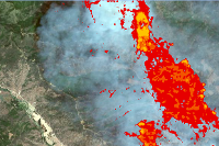
| Thumbnail |
|
| GUID | N/A |
| Name | N/A |
| Title | Pawnee Fire Analysis |
| Type | Notebook |
| Type Keywords | Notebook, Python |
| Description | In this notebook sample, you will use the sentinel-2 data to perform remote sensing. You will perform visual assessment of the burnt area, compute NBR on the pre fire and post fire scenes, compute the NBR difference to identify places that have been affected by the fire, normalize the values and classify the severity of the burnt areas all using raster functions. You will also perform human impact assessment due to the fire. |
| Tags | Raster, ArcGIS Image Server, Raster Analysis, GeoAnalytics, Raster Functions |
| Snippet | Perform wildfire analysis using Sentinel-2 Imagery Layer |
| Extent | N/A |
| Spatial Reference | N/A |
| Access Information | N/A |
| License Information | N/A |
| Culture | english (united states) |
| Properties | {"notebookRuntimeName":"ArcGIS Notebook Python 3 Standard","notebookRuntimeVersion":"10.7.1"} |
| Url | N/A |
| Proxy Filter | N/A |
| Last Modified | N/A |
| Size | 3325059 |
| Documentation | N/A |
| App Categories | N/A |
| Industries | N/A |
| Languages | N/A |
| Listed | false |
| Comments Enabled | true |
| # Comments | 0 |
| # Ratings | 0 |
| Avg. Rating | 0.0 |
| # Views | 273 |
| Categories | Data Science and Analysis |
| Content Status |
Child Resources: Comments Rating Groups Item Data Item Data as Zip Item Dependencies
Supported Operations: Add Comment Add Rating Delete Rating Related Items Share Item Unshare Item Package Item Set Item Content Status