Item (Public Information)
Item Card (XML) | Package Info| ID | 90b5fa6096574ac890403b048ef6aa5f |
| Item | dfd26d22da864699a08b9fd3d07346a4 |
| Item Type | text |
| Owner | esri_en |
| Uploaded | Feb 7, 2014 |
| Modified | Feb 7, 2014 |
| Thumbnail |

|
| GUID | N/A |
| Name | N/A |
| Title | Public Information |
| Type | Web Mapping Application |
| Type Keywords | compare, Configurable, createAppWithoutMap, JavaScript, local, Map, Mapping Site, Online Map, social, sourceId#dfd26d22da864699a08b9fd3d07346a4, Web Map |
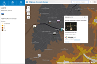
| Description | Public Information is a configurable app template that highlights areas through authoritative data feeds and social content, allowing the public to contribute to your map. Use Cases Enhance your map by overlaying social media feeds on your operational layers.
Configurable Options Public Information present content from a web map with social media feeds and can be configured using the following options:
Supported Devices This application is responsively designed to support use in browsers on desktops, mobile phones, and tablets. Data Requirements This application has no data requirements. Get Started This application can be created in the following ways:
|
| Tags | ArcGIS web application template |
| Snippet | Presents a map with geolocated content from Twitter, Instagram, Flickr, YouTube and webcams.travel. Optionally allows users to swipe between layers and print maps. |
| Extent | N/A |
| Spatial Reference | N/A |
| Access Information | N/A |
| License Information | This application will work with ArcGIS public accounts in addition to subscription based accounts. |
| Culture | en |
| Properties | N/A |
| Url | /apps/PublicInformation/index.html |
| Proxy Filter | N/A |
| Last Modified | N/A |
| Size | 9995 |
| Documentation | N/A |
| App Categories | [] |
| Industries | [] |
| Languages | [] |
| Screenshots |
screenshots/PIM_1.png screenshots/PIM_2.png screenshots/PIM_3.png screenshots/PIM_4.png |
| Listed | false |
| Comments Enabled | true |
| # Comments | 0 |
| # Ratings | 0 |
| Avg. Rating | 0.0 |
| # Views | 205 |
| Categories | |
| Content Status |
Child Resources: Comments Rating Groups Item Data Item Data as Zip Item Dependencies
Supported Operations: Add Comment Add Rating Delete Rating Related Items Share Item Unshare Item Package Item Set Item Content Status