Item (Damage Assessment)
Item Card (XML) | Package Info| ID | a1b8c2f4ab7347289905a2417728c22f |
| Item | a1b8c2f4ab7347289905a2417728c22f |
| Item Type | text |
| Owner | esri_apps |
| Uploaded | Nov 9, 2015 |
| Modified | Nov 9, 2015 |
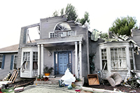
| Thumbnail |
|
| GUID | N/A |
| Name | N/A |
| Title | Damage Assessment |
| Type | Layer Template |
| Type Keywords | Collector, Damage Assessment, Data, Feature Service Template, General, Layer, Layer Template, Platform, Public Safety, Service Template, sourceId#b9bc2b3a2cf746a4aa3d8636080b11a0, Template |
| Description | Accounting for damage to residential and commercial structures following an event helps communities in recovery. This template is founded on FEMA standard forms used to collect structural damage assessments. |
| Tags | Emergency Management, Damage Assessment, State Government, Local Government, Assessment |
| Snippet | Accounting for damage to residential and commercial structures following an event helps communities in recovery. |
| Extent | [-88.35000110580798, 41.633291221494105] - [-87.91792454516012, 41.909222797010834] |
| Spatial Reference | WGS_1984_Web_Mercator_Auxiliary_Sphere |
| Access Information | City of Naperville, IL, Esri., Inc.; ArcGIS for Emergency Management |
| License Information | N/A |
| Culture | en-us |
| Properties | N/A |
| Url | N/A |
| Proxy Filter | N/A |
| Last Modified | N/A |
| Size | 4660 |
| Documentation | N/A |
| App Categories | N/A |
| Industries | N/A |
| Languages | N/A |
| Listed | false |
| Comments Enabled | false |
| # Comments | 0 |
| # Ratings | 0 |
| Avg. Rating | 0.0 |
| # Views | 246 |
| Categories | |
| Content Status |
Child Resources: Rating Groups Item Data Item Data as Zip Item Dependencies
Supported Operations: Add Rating Delete Rating Related Items Share Item Unshare Item Package Item Set Item Content Status