Item (Int)
Item Card (XML) | Package Info| ID | b26cd9ed80ba47d2b9654807eea507a1 |
| Item | Int.rft.json |
| Item Type | file |
| Owner | esri_en |
| Uploaded | Nov 15, 2018 |
| Modified | Nov 15, 2018 |
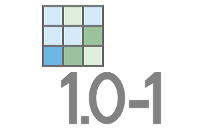
| Thumbnail |
|
| GUID | N/A |
| Name | N/A |
| Title | Int |
| Type | Raster function template |
| Type Keywords | ArcGIS Raster Function Templates, categoryName#MathSystem_RFT, Function Template, Functions, Processing, Raster, rft, sourceId#IntSystem_RFT, Templates |
| Description | The Int function converts each pixel value of a raster to an integer by truncation. |
| Tags | System Raster Function, Raster Function Template, Math, Int |
| Snippet | Converts each cell value of a raster into an integer by truncation. |
| Extent | N/A |
| Spatial Reference | N/A |
| Access Information | Esri, Inc. |
| License Information | This raster function template may be used to process your imagery using ArcGIS Image Server. |
| Culture | english (united states) |
| Properties | N/A |
| Url | N/A |
| Proxy Filter | N/A |
| Last Modified | N/A |
| Size | 1569 |
| Documentation | N/A |
| App Categories | N/A |
| Industries | N/A |
| Languages | N/A |
| Listed | false |
| Comments Enabled | true |
| # Comments | 0 |
| # Ratings | 0 |
| Avg. Rating | 0.0 |
| # Views | 332 |
| Categories | |
| Content Status |
Child Resources: Comments Rating Groups Item Data Item Data as Zip Item Dependencies
Supported Operations: Add Comment Add Rating Delete Rating Related Items Share Item Unshare Item Package Item Set Item Content Status