Item (Pansharpen)
Item Card (XML) | Package Info| ID | c227e25e5f2a4126b0415796427405d1 |
| Item | Pansharpen.rft.json |
| Item Type | file |
| Owner | esri_en |
| Uploaded | Nov 15, 2018 |
| Modified | Nov 15, 2018 |
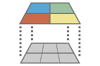
| Thumbnail |
|
| GUID | N/A |
| Name | N/A |
| Title | Pansharpen |
| Type | Raster function template |
| Type Keywords | ArcGIS Raster Function Templates, categoryName#AppearanceSystem_RFT, Function Template, Functions, Processing, Raster, rft, sourceId#PansharpenSystem_RFT, Templates |
| Description | The Pansharpening function uses a higher-resolution panchromatic image or raster band to fuse with a lower-resolution, multiband raster dataset to increase the spatial resolution of the multiband image. The purpose of pan sharpening is to create a higher quality visual image. Since the techniques alter the radiometry and spectral characteristics of the multiband imagery, pan sharpened imagery needs to be used with caution for analytical remote sensing purposes. |
| Tags | System Raster Function, Raster Function Template, Appearance, Pansharpen |
| Snippet | Artificially enhances the spatial resolution of a multiband image by fusing it with a higher resolution panchromatic image. |
| Extent | N/A |
| Spatial Reference | N/A |
| Access Information | Esri, Inc. |
| License Information | This raster function template may be used to process your imagery using ArcGIS Image Server. |
| Culture | english (united states) |
| Properties | N/A |
| Url | N/A |
| Proxy Filter | N/A |
| Last Modified | N/A |
| Size | 1649 |
| Documentation | N/A |
| App Categories | N/A |
| Industries | N/A |
| Languages | N/A |
| Listed | false |
| Comments Enabled | true |
| # Comments | 0 |
| # Ratings | 0 |
| Avg. Rating | 0.0 |
| # Views | 345 |
| Categories | |
| Content Status |
Child Resources: Comments Rating Groups Item Data Item Data as Zip Item Dependencies
Supported Operations: Add Comment Add Rating Delete Rating Related Items Share Item Unshare Item Package Item Set Item Content Status