Item (SCAT)
Item Card (XML) | Package Info| ID | cc05484b785a49beafe894af4f1b6710 |
| Item | cc05484b785a49beafe894af4f1b6710 |
| Item Type | text |
| Owner | esri |
| Uploaded | Sep 26, 2016 |
| Modified | Sep 26, 2016 |
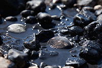
| Thumbnail |
|
| GUID | N/A |
| Name | N/A |
| Title | SCAT |
| Type | Layer Template |
| Type Keywords | Collector, Data, Environment, Feature Service Template, Layer, Layer Template, Petroleum, Platform, SCAT, Service Template, sourceId#954a1c959eee4468bb7d6871e106b841, Template |
| Description | When spilled oil contaminates a shoreline, responders must survey the affected areas to determine the best response. SCAT is designed to support decision-making for shoreline cleanup. This template is based upon the NOAA short form and can be used by field teams to assess the spill of oil along a coastline. |
| Tags | Natural Resources, SCAT, Petroleum, NOAA |
| Snippet | The Shoreline Cleanup and Assessment Collector Template based upon the NOAA short form. |
| Extent | [-180.0, -90.0] - [180.0, 90.0] |
| Spatial Reference | WGS_1984_Web_Mercator_Auxiliary_Sphere |
| Access Information | Esri, NOAA |
| License Information | N/A |
| Culture | en-us |
| Properties | N/A |
| Url | N/A |
| Proxy Filter | N/A |
| Last Modified | N/A |
| Size | 39761 |
| Documentation | N/A |
| App Categories | N/A |
| Industries | N/A |
| Languages | N/A |
| Listed | false |
| Comments Enabled | true |
| # Comments | 0 |
| # Ratings | 0 |
| Avg. Rating | 0.0 |
| # Views | 238 |
| Categories | |
| Content Status |
Child Resources: Comments Rating Groups Item Data Item Data as Zip Item Dependencies
Supported Operations: Add Comment Add Rating Delete Rating Related Items Share Item Unshare Item Package Item Set Item Content Status