Item (Imagery)
Item Card (XML) | Package Info| ID | d0135822507947b2a3809af36f2d91e6 |
| Item | Five20Map14876551 |
| Item Type | text |
| Owner | esri_en |
| Uploaded | Mar 8, 2012 |
| Modified | Mar 8, 2012 |
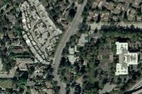
| Thumbnail |
|
| GUID | N/A |
| Name | 0110_Imagery |
| Title | Imagery |
| Type | Web Map |
| Type Keywords | ArcGIS Online, Explorer Web Map, Map, Online Map, sourceId#Five20Map14876551, Web Map |
| Description | This map features satellite imagery for the world and high-resolution aerial imagery for many areas. The map is intended to support the ArcGIS Online basemap gallery. For more details on the map, please visit the World Imagery map service description. |
| Tags | basemap |
| Snippet | This map features satellite imagery for the world and high-resolution aerial imagery for many areas. |
| Extent | [-180.0, -90.0] - [180.0, 90.0] |
| Spatial Reference | N/A |
| Access Information | N/A |
| License Information | This work is licensed under the Esri Master License Agreement. View Terms of Use |
| Culture | en-us |
| Properties | N/A |
| Url | N/A |
| Proxy Filter | N/A |
| Last Modified | N/A |
| Size | 409 |
| Documentation | N/A |
| App Categories | [] |
| Industries | [] |
| Languages | [] |
| Listed | false |
| Comments Enabled | true |
| # Comments | 0 |
| # Ratings | 0 |
| Avg. Rating | 0.0 |
| # Views | 88268 |
| Categories | |
| Content Status |
Child Resources: Comments Rating Groups Item Data Item Data as Zip Item Dependencies
Supported Operations: Add Comment Add Rating Delete Rating Related Items Share Item Unshare Item Package Item Set Item Content Status