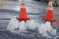
Item (Outage Details)
Item Card (XML) | Package Info| ID | d64d4e30889046b7bbc0cd4b4996816f |
| Item | d64d4e30889046b7bbc0cd4b4996816f |
| Item Type | text |
| Owner | esri |
| Uploaded | Sep 26, 2016 |
| Modified | Sep 26, 2016 |
| Thumbnail |

|
| GUID | N/A |
| Name | N/A |
| Title | Outage Details |
| Type | Layer Template |
| Type Keywords | Collector, Data, Feature Service Template, Layer, Layer Template, Outage Details, Platform, Platform Template, Service Template, sourceId#7b7357e61c484604b030993fb73d7879, Template, Water Utilities |
| Description | Record areas and assets affected during water outages. Outages can be identified using the Utility Isolation Trace app, by publishing the results of the Water Utility Network Editing and Analysis solution, or by manually sketching an outage area. |
| Tags | Outage, Trace, Water, Valves, Hydrants |
| Snippet | Enables water utilities to share outage information with their staff and customers. |
| Extent | [-134.48055576730692, 4.400959922289887] - [-62.92209409559497, 57.733328151502896] |
| Spatial Reference | WGS_1984_Web_Mercator_Auxiliary_Sphere |
| Access Information | Esri., Inc. |
| License Information | N/A |
| Culture | en-us |
| Properties | N/A |
| Url | N/A |
| Proxy Filter | N/A |
| Last Modified | N/A |
| Size | 62325 |
| Documentation | N/A |
| App Categories | N/A |
| Industries | N/A |
| Languages | N/A |
| Listed | false |
| Comments Enabled | true |
| # Comments | 0 |
| # Ratings | 0 |
| Avg. Rating | 0.0 |
| # Views | 185 |
| Categories | |
| Content Status |
Child Resources: Comments Rating Groups Item Data Item Data as Zip Item Dependencies
Supported Operations: Add Comment Add Rating Delete Rating Related Items Share Item Unshare Item Package Item Set Item Content Status