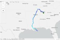
Item (Network Analysis: Track river pollutants)
Item Card (XML) | Package Info| ID | d909d8b6d6294fb4bffae94f4e8532a0 |
| Item | no_dumping_drains_to_ocean.ipynb |
| Item Type | file |
| Owner | esri_notebook |
| Uploaded | Apr 25, 2019 |
| Modified | Apr 25, 2019 |
| Thumbnail |

|
| GUID | N/A |
| Name | N/A |
| Title | Network Analysis: Track river pollutants |
| Type | Notebook |
| Type Keywords | Notebook, Python |
| Description | This notebook shows how to find the watershed area that drains to a storm drain and the route that pollutants will take if they are dumped or washed into the drain. |
| Tags | hydrology, trace downstream, watershed, pollution, water, conservation |
| Snippet | Use hydrology tools to create watershed boundaries and trace downstream path to analyze how pollutants reach larger water bodies |
| Extent | N/A |
| Spatial Reference | N/A |
| Access Information | N/A |
| License Information | - Needs AGO helper services configured |
| Culture | english (united states) |
| Properties | {"notebookRuntimeName":"ArcGIS Notebook Python 3 Standard","notebookRuntimeVersion":"10.7.1"} |
| Url | N/A |
| Proxy Filter | N/A |
| Last Modified | N/A |
| Size | 810634 |
| Documentation | N/A |
| App Categories | N/A |
| Industries | N/A |
| Languages | N/A |
| Listed | false |
| Comments Enabled | true |
| # Comments | 0 |
| # Ratings | 0 |
| Avg. Rating | 0.0 |
| # Views | 209 |
| Categories | Data Science and Analysis |
| Content Status |
Child Resources: Comments Rating Groups Item Data Item Data as Zip Item Dependencies
Supported Operations: Add Comment Add Rating Delete Rating Related Items Share Item Unshare Item Package Item Set Item Content Status