Item (Rasterize Features)
Item Card (XML) | Package Info| ID | e202a4e8425f4f749b1247f7fef1d1ea |
| Item | Rasterize_Features.rft.json |
| Item Type | file |
| Owner | esri_sr |
| Uploaded | Jan 7, 2019 |
| Modified | Jan 7, 2019 |
| Thumbnail |
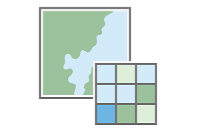
|
| GUID | N/A |
| Name | N/A |
| Title | Rasterize Features |
| Type | Raster function template |
| Type Keywords | ArcGIS Raster Function Templates, categoryName#ConversionSystem_RFT, Function Template, Functions, Processing, Raster, rft, sourceId#Rasterize FeaturesSystem_RFT, Templates |
| Description | Ova funkcija pretvara klasu podataka poligonalnih, polilinijskih i tačkastih geoobjekata u sloj rastera. Geoobjektima se dodeljuju vrednosti piksela na osnovu OBJECTID geoobjekata (podrazumevano). Opciono, vrednosti piksela mogu da se zasnivaju na polju vrednosti definisanom od strane korisnika u atributnoj tabeli ulaznog geoobjekta. |
| Tags | Sistemska rasterska funkcija, Šablon rasterske funkcije, Konverzija, Rasterize Features |
| Snippet | Pretvara geoobjekat u raster. |
| Extent | N/A |
| Spatial Reference | N/A |
| Access Information | Esri, Inc. |
| License Information | Ovaj šablon rasterske funkcije može da se koristi za obradu vaših snimaka korišćenjem ArcGIS Image Server. |
| Culture | english (united states) |
| Properties | N/A |
| Url | N/A |
| Proxy Filter | N/A |
| Last Modified | N/A |
| Size | 1596 |
| Documentation | N/A |
| App Categories | N/A |
| Industries | N/A |
| Languages | N/A |
| Listed | false |
| Comments Enabled | true |
| # Comments | 0 |
| # Ratings | 0 |
| Avg. Rating | 0.0 |
| # Views | 167 |
| Categories | |
| Content Status |
Child Resources: Comments Rating Groups Item Data Item Data as Zip Item Dependencies
Supported Operations: Add Comment Add Rating Delete Rating Related Items Share Item Unshare Item Package Item Set Item Content Status