Item (Site Selection: Restaurant clusters)
Item Card (XML) | Package Info| ID | ec8f6ab785b34a2792d69a4abd05dc4b |
| Item | Finding_Zones_For_a_New_Restaurant_Using_Clustering.ipynb |
| Item Type | file |
| Owner | esri_notebook |
| Uploaded | Apr 25, 2019 |
| Modified | Apr 25, 2019 |
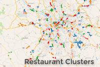
| Thumbnail |
|
| GUID | N/A |
| Name | N/A |
| Title | Site Selection: Restaurant clusters |
| Type | Notebook |
| Type Keywords | Notebook, Python |
| Description | This notebook will use the spatially-enabled dataframe to explore a dataset of restaurants, showing charts, maps, and performing clustering analysis to determine the potential best zones for a new restaurant. |
| Tags | Clustering, Ranking, Scoring, Planning |
| Snippet | Perform data exploration and analysis to find zones for a new restaurant in Pittsburgh, PA. |
| Extent | N/A |
| Spatial Reference | N/A |
| Access Information | N/A |
| License Information | - Uses arcpy |
| Culture | english (united states) |
| Properties | {"notebookRuntimeName":"ArcGIS Notebook Python 3 Advanced","notebookRuntimeVersion":"10.7.1"} |
| Url | N/A |
| Proxy Filter | N/A |
| Last Modified | N/A |
| Size | 8097069 |
| Documentation | N/A |
| App Categories | N/A |
| Industries | N/A |
| Languages | N/A |
| Listed | false |
| Comments Enabled | true |
| # Comments | 0 |
| # Ratings | 0 |
| Avg. Rating | 0.0 |
| # Views | 331 |
| Categories | Data Science and Analysis |
| Content Status |
Child Resources: Comments Rating Groups Item Data Item Data as Zip Item Dependencies
Supported Operations: Add Comment Add Rating Delete Rating Related Items Share Item Unshare Item Package Item Set Item Content Status