Item (Tasseled Cap (Kauth-Thomas))
Item Card (XML) | Package Info| ID | f5fdf20767d14079827d96e902cd5973 |
| Item | Tasseled_Cap_(Kauth-Thomas).rft.json |
| Item Type | file |
| Owner | esri_en |
| Uploaded | Nov 15, 2018 |
| Modified | Nov 15, 2018 |
| Thumbnail |

|
| GUID | N/A |
| Name | N/A |
| Title | Tasseled Cap (Kauth-Thomas) |
| Type | Raster function template |
| Type Keywords | ArcGIS Raster Function Templates, categoryName#AnalysisSystem_RFT, Function Template, Functions, Processing, Raster, rft, sourceId#Tasseled Cap (Kauth-Thomas)System_RFT, Templates |
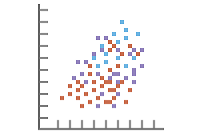
| Description | The Tasseled Cap (Kauth-Thomas) transformation is designed to analyze and map vegetation phenomenology and urban development changes detected by various satellite sensor systems. It is known as the Tasseled Cap transformation due to the shape of the graphical distribution of data. The transformation provided a rationale for the patterns found in Landsat MSS data of agricultural fields as a function of the life cycle of the crop. Essentially, as crops grow from seed to maturity, there is a net increase in near-infrared and decrease in red reflectance based on soil color The utility of this transformation has expanded from monitoring crops to analyzing and mapping vegetation to support a variety of applications such as forestry, industrial vegetation management, ecosystem mapping and management, inventory and monitoring for carbon sequestering and credits, urban development, and more. It has also expanded from supporting Landsat MSS to include other popular satellite systems such as Landsat TM, Landsat ETM+, Landsat 8, IKONOS, QuickBird, WorldView-2 and RapidEye multispectral sensors. |
| Tags | System Raster Function, Raster Function Template, Analysis, Tasseled Cap (Kauth-Thomas) |
| Snippet | Calculates levels of vegetation, wetness and brightness. This technique relies on coefficients that must be calculated specifically for a sensor. |
| Extent | N/A |
| Spatial Reference | N/A |
| Access Information | Esri, Inc. |
| License Information | This raster function template may be used to process your imagery using ArcGIS Image Server. |
| Culture | english (united states) |
| Properties | N/A |
| Url | N/A |
| Proxy Filter | N/A |
| Last Modified | N/A |
| Size | 743 |
| Documentation | N/A |
| App Categories | N/A |
| Industries | N/A |
| Languages | N/A |
| Listed | false |
| Comments Enabled | true |
| # Comments | 0 |
| # Ratings | 0 |
| Avg. Rating | 0.0 |
| # Views | 256 |
| Categories | |
| Content Status |
Child Resources: Comments Rating Groups Item Data Item Data as Zip Item Dependencies
Supported Operations: Add Comment Add Rating Delete Rating Related Items Share Item Unshare Item Package Item Set Item Content Status